Understanding Hudson River Basics
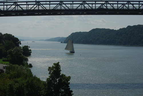
The Hudson is really two rivers: a freshwater river that starts in the Adirondacks and flows south to Troy, New York where it spills over the Federal Dam and a tidal estuary between Troy and New York City flowing both north and south, and rising and falling with the ocean’s tides. From Mount Marcy in the Adirondacks to the Federal Dam, the river’s elevation drops from over 4,000 feet to about 4 feet. From Troy to the Battery in NYC, a distance of over 150 miles, the river is barely above sea level. The Hudson River Estuary is also considered a fjord, a drowned river valley cut by a glacier. Some 20,000 years ago, miles of ice lay on top of the Hudson Valley. The massive glacier cut through the mountains and eventually left a pile of debris as it retreated – this pile of debris became Long Island. The fjord nature of the river is most evident in the Hudson Highlands near West Point. The estuary is where the Clearwater sails and where amazing diversities of life and habitat are found.
Read The State of the Hudson! This is an illustrated, comprehensive report published in 2015 by the New York Department of Environmental Conservation’s Hudson River Estuary Program, covering a variety of current issues on the river.
Below is detailed information that is often covered in our educational stations during onboard educational programs.
Our Core Stations
Fish Station
 Over 200 species of fish live in the Hudson watershed. Some fish are native to the Hudson like the white perch, Morone americana, while others, like the common carp, Cyprinus carpio, are invasive, unwelcome, and sometimes destructive guests. The Hudson estuary is a great example of biodiversity. Giants like the Atlantic sturgeon, Acipenser oxyrinchus, patrol the river bottom eating shellfish and sometimes leaping into the air, much to the astonishment of onlookers. Others are tiny, like the three-spined sticklebacks, Gasterosteus aculeatus, who make nests by gluing together bits of vegetation.
The saltwater-freshwater nature of the estuary can prove challenging for fish, but some species can take advantage of this, spending part of their lives in the Hudson and another part in the ocean. Striped bass, American shad, and sturgeon spend much of their adult lives in the ocean, returning to the Hudson to lay their eggs (spawn). These fish are considered to be anadromous (salmon are another species of anadromous fish, though there are no salmon in the Hudson). American eels do the reverse, spending most of their lives in the freshwater part of the Hudson before returning to the ocean to spawn. Eels are catadromous.
You can tell a lot about a fish by its adaptations. Adaptations are tools for survival. For a fish, these include the shape and size of its mouth, coloration, ability to process salt, lateral line, and fin structure. The lateral line is a distinct line along the side of some fish. Inside the line are cells with tiny hairs that are sensitive to movement in the water, sort of like built in motion detectors. Look for this feature at the fish station.
When you visit the fish station, try to figure out what the fish’s niche is. A niche is the role a species plays in its ecosystem. Some fish are generalists, like carp, while others are very specialized, like a seahorse. Some fish are apex predators at the top of the food chain (striped bass). Other species swim in schools, like killifish, and are often eaten by larger fish. Still others are scavengers, like catfish.
Hold the anchovies! Yes, the Hudson River has anchovies, though not the same ones found on pizza. Bay anchovies, Anchoa mitchilli, have eyes out of proportion to their heads, and a big overbite. They can open their mouths wide to strain the water for plankton. Something is considered to be plankton if it is carried by tides and currents and cannot swim against these forces. Most plankton are small, although some jellyfish can reach dozens of feet long. Plankton is either phytoplankton (like a plant, photosynthetic) or zooplankton (like an animal). Plankton is a crucial part of the Hudson food chain.
Striped bass, Morone saxatilis, are predators that rule the top of the fish food chain in the Hudson, but they are only temporary visitors, spending most of their lives out in the ocean. American shad, Alosa sapadissima, also only visit the Hudson to spawn. Shad “roe” is considered a local delicacy, but shad numbers have dropped so low in the Hudson that fishing for them is no longer allowed.
What’s a hogchoker, Trinectes maculatus? We call them the “sole of the Hudson”. This little flatfish is the unofficial mascot of Clearwater. What is this fish’s niche? What are its adaptations? How did they get that bizarre name? Ask onboard.
Imagine a species of fish that has been around since the time of the dinosaurs, with bony ‘scutes’ instead of scales, and a mouth that looks like a vacuum hose. That’s the Atlantic sturgeon, the largest fish in the Hudson. Sturgeon eggs are valuable as caviar, an expensive delicacy. Sturgeon were once called “Albany beef” because they were so plentiful, but now fishing for sturgeon is no longer allowed. Why not?
Clearwater and many other river organizations are constantly monitoring and educating the public on our fish populations. Read current information on Hudson River fish research on Riverkeeper’s website.
Indigenous Peoples Station
Indigenous people are people of a given land who are directly descended from the earliest known inhabitants of that particular geographic region. The Hudson River and the land surrounding it were inhabited by and cared for by indigenous people for 400 generations before Europeans violently colonized, and there have been only 16 generations since that moment of contact.
The terms “Indigenous” and “Native American” are generalizations. There are people indigenous to every geographic region in the world, and there are many people who identify as indigenous or native american on this continent who descend from different specific tribes and nations of people with varying cultures, languages, and religious/spiritual beliefs. The indigenous groups who lived alongside the Mahicannituck—the Mohican name for the river—included the Mohican, Haudenosaunee, Munsee Lenape, and Wappinger peoples. Descendents of people from these groups continue to live in the United States today, but there are not large numbers of these descendents in the Hudson Valley since being forced to move west into reservations by European colonizers.
Today, many indigenous people and groups are leaders in environmental protection, fighting dirty and extractive energy cycles, protecting clean water, protecting wildlife, and more. Often it is taught in schools that indigenous people were a “moment in history.” We must break that narrative and teach the truth, which is that indigenous people are valued members of our communities today. When Europeans colonized this land, they began a cycle of systemic oppression that continues today. You can educate yourself on the indigenous land you are on at this website and honor the history and present day lives of the original people of that land. It is important to recognize whose land you are on—who it was inhabited by before they were forced to migrate. One meaningful way to honor indigenous people is to perform a land/water acknowledgement: a formal recognition of any and all original peoples and protectors of the land, waterways, and their connection to it.
From the website, seedingsovereignty.org:
Pronunciation guide: “MA – HI – CAN – I – TUCK”
“We are gathered today to honor and call this land by its original name: Mahicannituck. Mahicannituck was, and is home to the Mohican, Haudenosaunee, Munsee Lenape, and Wappinger people; the original guardians of this territory. We uplift, honor, and speak the traditional names of the land and people to remind this community and all other visitors, that these peoples did, and do still exist. Without their committed stewardship, we would not be enjoying this place today. Anushiik (pronounced ah-noo-sheek) / Thank you.”
We cannot stop at a land acknowledgment—learn about the history of indigenous groups where you live and on this continent, educate your friends and family, uplift native voices and causes.
Navigation Station
Whether it is biking to work, walking to school, or giving directions to a friend, we use some form of navigation every day. When you come aboard Clearwater, you will find that our captain and crew do not rely on a GPS or digital chart plotter to navigate the ship. Instead, students, volunteers and crew alike use paper charts of the river, compasses, visual aids and simple math for river navigation. Lighthouses, floating buoys, bridges and even church steeples are navigational aids for determining the location of the vessel as well as direction and speed of travel.
Because the Hudson is a tidal estuary, the ever-changing current is often the most important influence on the boat’s progress along the river. On a three-hour sail, Clearwater might leave the dock with the tide going out, pulling us towards the ocean, only to return to the dock with the water flowing in the opposite direction. At times the strength of the current is so great that even with our sails are full, the boat moves backwards. When you are near the river, tossing a stick in the water is a great way to observe the direction and speed of the current. The amount of rainfall can affect the currents but they are primarily determined by the sun and moon’s gravitational pull, creating high and low tides. The tides can be predicted far into the future with great accuracy and these are published for mariners to consult in tide tables.
Wind in the sails propels Clearwater across the surface of the water. The speed and direction of this mighty force is constantly changing and affecting how fast and in which direction the boat will move. There are many ways to observe the wind’s activity; such as a wind speed indicator, surface water texture, a flag flying or the feel of it across your skin. The wind direction and strength will help the captain determine Clearwater’s course and when to make maneuvers such as tacks or gybes.
Determining the water depth is also essential for sailing safely on the Hudson River. This can be done with a number of tools such as a sonar depth sounder or lead line. Clearwater was specifically designed for this river, so it goes only six and a half feet below the surface of the water with our centerboard up. With such a shallow draft, much of the Hudson is accessible to us, however, if we navigate into shallower water, the vessel would be resting on the bottom.
Water Quality Station
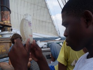
At the Water Quality Station, we discuss the state of the water and what affects it, and test some parameters such as dissolved oxygen, pH, salinity, and turbidity.
Oxygen
Every breath we take contains about 21% oxygen. That’s a huge amount compared to what’s available to fish in the water. Even though water is made up of oxygen (H₂O), that oxygen is not useful for breathing. Instead fish and other aquatic organisms must rely on oxygen that’s dissolved in the water. Oxygen in the water is measured in parts per million (or milligrams per liter). Four parts per million (4ppm) is considered the minimum amount of oxygen to sustain fish life. Some species, like trout, need much more while others, like carp, can survive at very low levels.
On Clearwater, we test the oxygen levels with a titration. You will add drops of an indicator solution to a prepared sample of Hudson River water and look for a color change. Once the sample turns from yellow to clear, the test is over. The total number of drops used to turn the sample clear represents the amount of dissolved oxygen (DO) in parts per million.
Just because the water may have 4 or more ppm of dissolved oxygen, that doesn’t mean it is healthy. What if the sample you tested had 5ppm but should have much more, maybe 9ppm? If the water isn’t holding all the oxygen it should be, that might be an indication of pollution, such as sewage. For more context, we take the water’s temperature. We know how much oxygen the water should hold at a given temperature. Colder water can hold more oxygen than warm water. Using a special chart and our DO and temperature data, we can see if the water is close to saturation, or if it should be holding more.
Sometimes sewage spills into the Hudson. That provides food for bacteria and the bacteria multiply, using up lots of oxygen thus lowering the levels in the water.
pH
We will test the acidity/alkalinity level of the Hudson using a simple pH test. pH is measured on a scale of 0 to 14. The lower the number, the more acidic a sample is. Seven on the pH scale is neutral. Rainwater is normally slightly acidic at around 5.5, but acid rain can be much more acidic (around 4). Each point on this scale represents 10 times more acidity, so a pH of 5 is ten times more acidic than a pH of 6 and a hundred times more acidic than 7. This is called a logarithmic scale. What was the pH of your sample? The cool thing about the Hudson River is that the pH is always between 7 and 8. The limestone bedrock in the Hudson’s watershed creates a natural buffer, neutralizing any acid rain.
Salinity
Even freshwater streams have some small amounts of salt dissolved from the land. Since the Hudson is an estuary, saltwater moves far upriver, creating something called the salt front, the leading edge of the salt upriver, where the measured amount of ocean salt (100 mg/l) can be detected in the river. You couldn’t taste this amount of salt in the water, but it’s an indication of the ocean’s presence. Saltwater is denser than freshwater and this tends to inhibit mixing. During the spring, with all of the snowmelt from the mountains, huge volumes of freshwater push the salt front down toward the ocean. By late summer, much less freshwater flows into the Hudson, so the ocean saltwater gets a chance to push north. To find out where the salt front is today, click this link: http://ny.water.usgs.gov/projects/dialer_plots/saltfront.html
When finding the level of salinity onboard the boat you will be measuring in parts per thousand (ppt). You can observe the salinity at home by using Clearwater’s Hudson River Environmental Conditions Observation System sensor at (www.hrecos.org) where salinity is measured in Practical Salinity Units. For our purposes the two can be used interchangeably.
This all proves a challenge to fish. Salt can determine whether or not a fish can live in a certain area. Some fish are not very salt tolerant and need freshwater. Some need to be in fairly salty water. But in the Hudson, there are fish that can adapt to varying levels of salinity. Eels, white perch, banded killifish, and hogchokers are all in that category. Some fish, like shad and striped bass, spend most of their lives in saltwater and only come upriver to spawn. These fish are anadromous. Eels, on the other hand, spend most of their adult lives in the river, returning to the ocean to spawn. Eels are catadromous.
Turbidity
This is a measure of total suspended solids (TSS), or, stuff suspended in the water. The Hudson is naturally turbid, or murky. Much of this material washes in from the tributaries. It is mostly fine clay particles, so fine that the water keeps them in suspension. Too much turbidity is an indication of soil erosion. Hudson River fish generally have a high tolerance to turbidity. We can measure it using a Secchi disk or a turbidity tube. The more turbid the water, the harder it is for light to pass through.
HRECOS
In 2010, Clearwater was equipped with sophisticated water quality monitoring equipment and became a part of a river-wide network that measures water quality. The network is called HRECOS (Hudson River Environmental Conditions Observing System) and provides real time data, relayed back to the Internet, where anyone can access it. Visit HRECOS here: www.hrecos.org.
Additional Education Topics
Invertebrates
Animals without backbones – in the Hudson, these can be tiny, Cyclops-like copepods or large blue crabs. The world of invertebrates is vast and diverse and they can serve as indicator species, telling us about the health of the ecosystem in which they live by their presence or absence. There are the mollusks, like oysters and clams. Crustaceans include crayfish, crabs, barnacles, and shrimps. The freshwater parts of the river are home to many insect larvae, which may eventually transform into adult mosquitoes, mayflies, midges, dragonflies, or beetles. Then there are shell-less worms, including leeches and clamworms.
At the Hudson River life station, the invertebrate you are most likely to encounter is the humble amphipod (Gammarus), often called a “scud”. Scuds look like tiny shrimp and scavenge along the river bottom, eating detritus, dead plant and animal material. A tremendous amount of energy enters the Hudson from dead plants and leaves washing in from the tributaries. Scuds do a great job of cleaning up the bottom of the river and they provide food for a host of fish species.
Copepods are probably the most numerous animal group on the planet. They are vital to river and ocean food chains, providing food to larval fish that are just getting started in life. They’re very small, but you can see them with the naked eye.
Are there any zebra mussels, Dreissena polymorpha, in your sample? These invasive mollusks got into the Hudson River accidentally when free-swimming larvae escaped from the ballast water of ships from Eurasia. Once in the Hudson, zebra mussels reproduced at a fast rate They attach themselves to any hard surface, including boats, pipes, docks, and even the shells of native clams, by secreting byssal threads. Zebra mussels also filter the water, removing plankton and oxygen from the water. You will only find zebra mussels in freshwater. They are intolerant of salt.
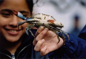
The Hudson is known for its blue crabs Callinectes (“beautiful swimmer”) sapidus (“savory”). These crustaceans move into freshwater parts of the river during the summer. Their ten legs have different jobs: the first pair are the dangerous claws; the middle three pairs are walking legs; the back legs are flattened, serving as paddles and making this crab an effective swimmer.
Chinese mitten crabs, Eriocheir sinensis, are a recent arrival in the Hudson. They are potentially an invasive species (any animal or plant that has arrived from another place and has become destructive in the Hudson). Mitten crabs are known for the hair-like tufts on their claws that resemble mittens. The exact purpose of these “mittens” is unknown. These crabs lack the swimming feet and are designed more for walking and burrowing.
Sail Physics
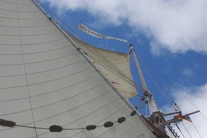
What better way to learn about sail physics than by looking up at one of the largest mainsails in America?
Sails harness the energy of the wind . When a sail catches wind it acts just like an airplane wing, creating lift. This is a function of the sail and an airplane wing both being foils.
When air passes over a foil it must travel over a greater distance, at a greater speed creating lower air pressure on one side and over a shorter distance, at a slower speed creating high air pressure on the other.
Molecules in a high-pressure area like to move directly to a lower pressure situation. By walking to the leeward or rounder of the sail you can feel the air moving faster than on the windward or hollow side where it will feel less windy. This difference in pressure on either side of the sail is necessary for the Clearwater to travel across the surface of the water.
Below the surface of the water the keel, rudder, and centerboard become very important as the sails begin to catch wind and push the boat through the water. Without water flowing past these fins, Clearwater would slide sideways through the water. When water passes over the large surface area of these fins, they redirect the sideways motion of the boat into a more forward course, allowing us to sail closer to the direction the bow points. If you watch very carefully, you will notice our leeway; Clearwater still travels slightly sideways through the water.
In order to slow a sailboat, the wind must be spilled from the sails making the foil disappear. You will notice when the crew set or drop the mainsail, our captain keeps Clearwater head to wind in order to maintain air passing evenly over both sides of the sail. In this case, the sail is essentially a flag and will not propel the boat forward.
Another time you may see Clearwater head to wind is as the boat is turning through a tack or gybe. After the captain has determined the general direction in which he/she wants the vessel to travel, a number of zigzags might be necessary to arrive at the chosen destination. A tack is when the bow of the boat passes through the wind, a gybe is when the stern passes through the wind. A Hudson River Gybe is a dramatic event that you may be lucky enough to witness while aboard Clearwater.
Explore these two websites for more information on the physics of sailing:
http://blog.everydayscientist.com/wp-content/uploads/physics-sailing.pdf
http://ffden-2.phys.uaf.edu/211_fall2002.web.dir/josh_palmer/Home.html
Microplastics
Microplastics are defined as small fragments of plastic marine debris smaller than 5mm. They are an emerging issue on the Hudson River. Unlike macroplastics (i.e. a floating beverage bottle or cigarette butt) microplastics cannot be easily seen with the naked eye, but are still incredibly damaging to the environment. Microplastics can enter an estuarine system in several ways.
The most common way microplastics are formed are through larger pieces of plastic breaking down into small fragments. These plastics can be found anywhere from the top to the bottom of the ocean. When these plastics interact with UV rays, wind and wave action, they can be broken into smaller and smaller fragments, turning into microplastics.
Many personal care items such as face wash, shampoo, and toothpaste, utilize plastic microbeads as agents of exfoliation. Likewise, many synthetic fabrics can shed plastic fibers while in the washing machine. When water from either situation is drained, those microplastics make their way to the sewage treatment plant before re-entering the water system. However, these plants are unable to filter out microplastics, and as a result, they make their way into the Hudson River.
Because the Hudson River is a tidal estuary for about 150 miles, it can trap plastics in a back and forth motion, creating a longer exposure time to the estuary system, a critical habitat for young migratory fish.
Micro-plastics can affect the ecosystem in multiple ways. Scientists have found plastics from the surface to the bottom of the ocean. Firstly, they can be confused as food: Small predators or filter feeders may fill their stomachs with plastic instead of food, leading to malnutrition and even starvation. Predators higher on the food chain can accumulate plastics by eating contaminated prey items. They can also accumulate toxins: Plastics have been found to absorb toxins on its exposed surface, which can enter the food web when ingested. PCB’s are one example of a chemical that can be absorbed in this substrate. Lastly, they can promote microbe colonies: Plastic can create a home to possibly harmful microbe colonies.
What would it take to clean out all the plastic? Is it possible? What can we do to prevent more plastic from going into the Hudson? These are all questions worth exploring as we move forward in learning how to maintain a safe and healthy planet!
Art
As with all past developments in culture and civilization, art played an integral role in defining the Hudson Valley as we see it today.
The Hudson River School was a style of artwork inspired by the landscapes of the Hudson Valley that was popular from 1825-1875. Thomas Cole is considered the father of the movement, but many others followed including Asher Durand, Fredric Edwin Church, and Jasper Francis Cropsey. This growing group of artists came from all over Europe to paint the Hudson River- famous for its beautiful landscapes and captivating scenery. Paintings of this style were landscapes, containing people (or at least evidence of human influence), and nature, often with a dramatic dark/bright lighting difference. HR School paintings glorified nature. They made people want to protect the Hudson- not just nature but human life on the river. It contrasted civilization and wilderness and became a unique style that was used across the USA. These paintings inspired many city dwellers to travel north, on sloops or the Hudson River Railroad, to see these epic landscapes for themselves.
As you may have already learned in the Indigenous Peoples Station, the indigenous folk of this land, the Munsee Lenape people, have lived here for over 400 generations before European colonization. It is incredibly important to be able to acknowledge their art as historic and hugely developmental as we do with art that was made by Europeans post-colonization. Their history is American history. An astonishing example of this is the bear petroglyph at The Rocks Trail in Pound Ridge; a depiction of a black bear, its head looking over its shoulder, incised in a boulder. Indigenous peoples in the Northeast have revered the bear for millennia, making it difficult to date this creation. It is considered one of the finest examples of Indigenous rock art in the state. You can visit this historic site at Ward Pound Ridge Reservation in Westchester County. Hike the full eight-mile loop at this 4,300-acre park to also view a rock shelter once inhabited by Lenape peoples.
Climate Change
Climate change is the defining environmental issue of our lifetime. We have put together resources to help educators and students learn about climate change impacts on the Hudson River, as well as how we can all be a part of climate solutions. Check out our virtual climate change education materials, here!
In addition to the resources we have collected on our climate change education page, there are so many other great sources of information out there. Here are a few!
Read this article from theotherhudsonvalley.com: Here’s How Climate Change Could Affect the Hudson Valley
And this article on the impacts of climate change on rivers.
From Scenic Hudson: Climate Change in the Hudson Valley

 Water Quality Station Video